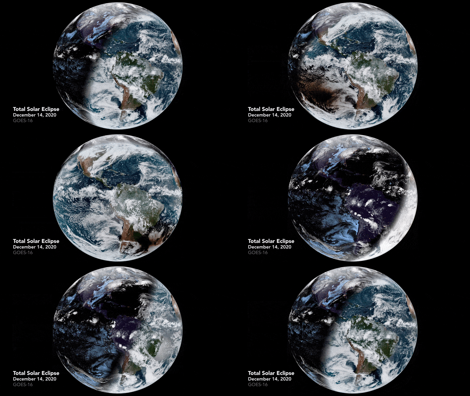

The first and only total solar eclipse of 2020 occurred on Dec. 14, with the path of totality stretching from the equatorial Pacific to the South Atlantic and passing through southern Argentina and Chile.

December 14, 2020
The Advanced Baseline Imager (ABI) on Geostationary Operational Environmental Satellite 16 (GOES-16) captured images of the moon’s shadow crossing the Earth’s surface. GOES-16 is operated by the National Oceanic and Atmospheric Administration (NOAA); NASA helps develop and launch the GOES satellite series.

December 14, 2020
A solar eclipse occurs when the moon passes between the Earth and the sun, obscuring all or part of the image of the sun to a viewer on Earth. A total solar eclipse occurs when the apparent diameter of the moon is greater than that of the sun, blocking all direct sunlight and turning the day into darkness. Totality takes place in a narrow path across the Earth’s surface, with the partial eclipse visible over a surrounding area thousands of miles wide.
The time-lapse video above features 72 images taken every 10 minutes between 6:00 AM and 1800 Universal Time (3:00 AM and 3:00 PM in southern Chile) on December 14.
NASA Earth Observatory video and images by Joshua Stevens, using GOES 16 images courtesy of NOAA and the National Environmental Satellite, Data and Information Service (NESDIS) and NASA / GSFC umbrella shadow calculations.