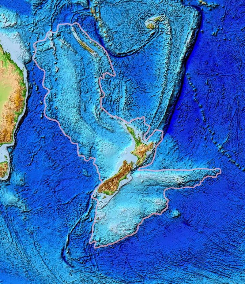
Scientists are mapping the mysterious ‘lost’ continent of Zealandia for the first time, which was discovered in 2017. The gigantic landmass in the South Pacific disappeared beneath the waves 23 million years ago.
It was originally part of the gigantic supercontinent Gondwana, which was made up of continents that now exist in the Southern Hemisphere.
With an area of 1.9 million square miles, Zealandia is six times the size of Madagascar, the second largest continental fragment.
It stretches from southern New Zealand north to New Caledonia and west to the Kenn Plateau off Australia’s east coast.
About 94 percent of the landmass is under water.
The ‘hidden’ continent is now partially mapped thanks to a deep-water mapping expedition led by the University of Queensland, The sun reported.
Chief scientist Dr. Derya Gürer spent 28 days at sea on the Schmidt Ocean Institute’s research vessel Falkor, exploring the northwestern edge of the continent.
“We are just beginning to discover the secrets of Zeelandia,” said Dr. Gürer. “It was hidden in plain sight until recently and is notoriously difficult to study.”
Radar scans conducted by the team explored the contours of the close connection between the Tasman Sea and the Coral Seas in the Cato Trough region – the narrow corridor between Australia and Zealandia.
In total, they provided 14,000 square miles of topographic data to the Seabed 2030 project.
The project aims to produce a publicly available bathymetric map to measure the depth of the world’s ocean floor depth by 2030.
Read more: Scientists discover a new continent called ‘Zealandia’
“The seabed is full of clues to understand the complex geological history of both the Australian and Zeeland continental plates,” said Dr. Gürer.
“This data will also improve our understanding of the complex structure of the crust between the Australian and Zeeland plates. It is thought to include several small continental fragments or microcontinents that split off from Australia and the supercontinent Gondwana in the past. “
Zealandia is said to have broken down from Gondwana between 85 and 79 million years ago.
The supercontinent encompassed what is now South America, Africa, Antarctica, Australia, Zealandia, Arabia, and the Indian subcontinent.
About 23 million years ago, Zealandia was thought to be almost completely submerged in water.
Experts have collected data for 20 years to ensure that the submerged landmass is a continent. Their efforts have been frustrated because most of it is hidden under the waves.
The article originally appeared on The Sun